The complete guide to Preikestolen
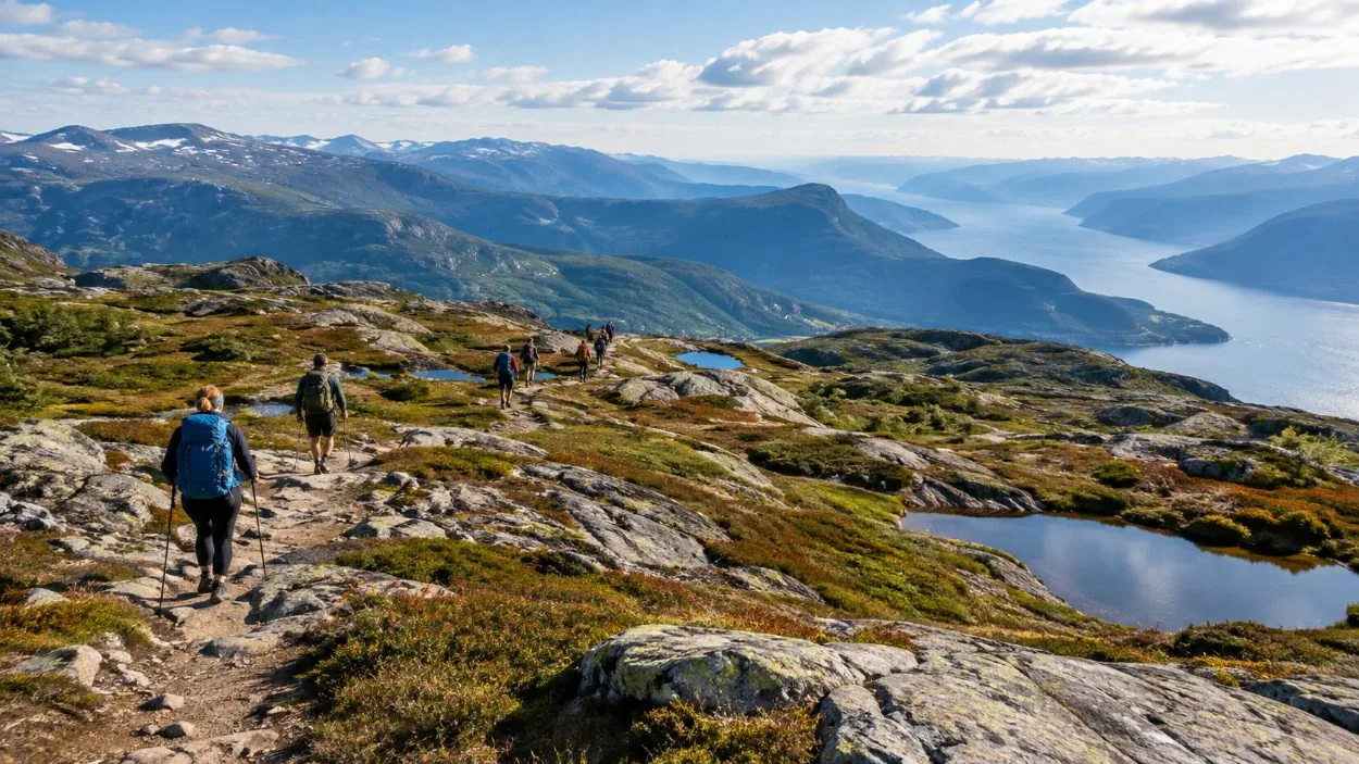
Preikestolen is a flat granite plateau, roughly 25 by 25 metres, standing 604 metres above the Lysefjord in Strand, Rogaland, and reached by a free, unguided public trail of about 8 km round trip that takes an average walker 4 to 5 hours. I grew up in Jørpeland, three kilometres down the road from the car park, and I still live there. When I was small this was a Sunday walk local families did in borrowed boots. Roughly 350,000 people a year come up it now, and most of what goes wrong for them comes from one misunderstanding.
The hard part is not the height
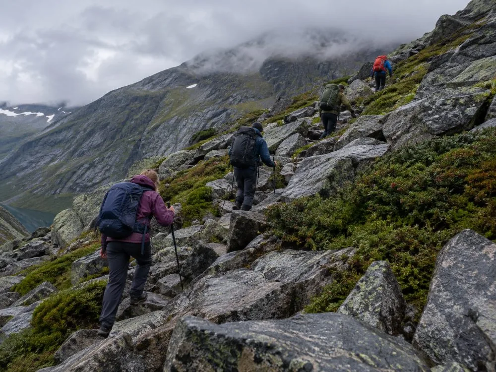
People arrive expecting a viewpoint and find a mountain walk. That is the whole of it. The climbing is somewhere between about 350 and 500 metres depending on how you count the dips, and the difficulty lives in the surface rather than the gradient: forest path, stone steps, a field of bare granite blocks you cross one at a time, boardwalks over marsh, then open rock along the fjord edge. Four to five hours of that. The photographs you have seen were taken from a drone or from a boat, so they show the plateau and none of the middle. Most of the steps were laid by Nepalese Sherpa trail builders, on this path largely between 2013 and 2016; they made the route durable rather than short. Read how hard it is before you decide, not after.
Nobody sells a ticket to this
There is no gate, no permit, no time slot and nobody taking your name. The trail never formally closes; the nearest thing to a closure is the staff at the car park advising against walking in bad conditions, and you should take that advice. So anything sold with Preikestolen in the title is selling one of three other things. The ride, because the trailhead is about an hour outside Stavanger and there is no practical way to reach it without wheels. The guide, optional in summer and a different matter in winter. Or the boat, which looks up at the cliff from 604 metres below and never lands. The long version is on what the day costs.
Getting here, and the ferry that no longer exists
From Stavanger it is Highway 13 through the Ryfylke Tunnel, off at Solbakk, then road 523 to Jørpeland: 45 to 60 minutes. Worth saying loudly, because I still meet people at the quay in town looking for it: the Stavanger–Tau car ferry closed when the tunnel opened on 30 December 2019, so guidebooks that route you onto it are out of date. Without a car there is a seasonal bus from Byterminalen, up to nine a day from around 20 June to around 13 September and only two morning departures in March and April, with tickets sold online rather than on board. Outside those months there is effectively no bus, which is when a booked tour stops being a convenience: getting there.
There is no railing, and that is deliberate
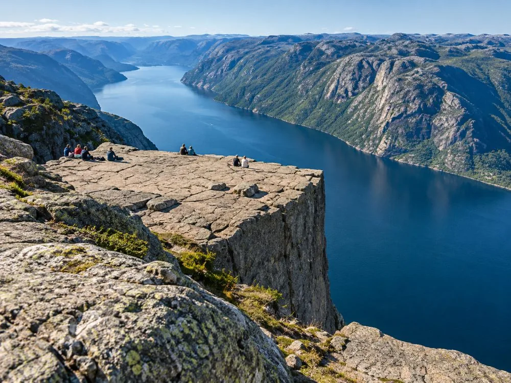
The plateau ends. No fence, no barrier, no chain, by choice of the land managers, who would rather the place stayed as it is. A fall from the edge is around 250 metres and is not survivable. The first reported tourist fatality is dated October 2013, and on 3 June 2024 a Norwegian man hiking alone fell roughly 150 to 200 metres from the summit area. There is no complete public count of deaths here, partly because Norwegian media does not report suspected suicides, so I will not give you a number. I will say that hikers have to be rescued every year, that tired legs come unstuck on the way down, and that the emergency number in Norway is 113. See how safe it is.
The crack, without the drama
A gap about half a metre wide and several metres deep runs across the plateau, watched with bolts since around 1930. In May 2017 the Geological Survey of Norway measured it 2 to 3 mm wider, the first detected movement in 22 years, and said explicitly that it was not panicking. The current assessment is that there is no foreseeable safety risk and that nobody alive should expect it to fall. The shape itself came from the end of the last ice age, roughly 10,000 years ago, when frost levered angular blocks out of a wall the glacier had steepened. The crack has its own page, because it is the question I am asked most.
Winter is a different mountain
From roughly November to March, go with a guide or at least not alone. Visit Norway and the trail’s own operators say the same. Snow fills the gaps between the boulders and hides the streams, the rock ices, and the daylight is short enough that a slow group finishes in the dark. Crampons are normal kit, and the guided winter option provides them when the ice requires them: the winter hike.
If you are not going to walk it
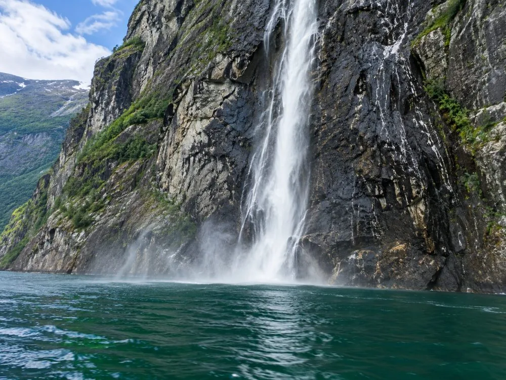
The Lysefjord cruise leaves Strandkaien on a fully electric catamaran, passes Hengjanefossen and the Vagabond’s Cave, and looks up at the plateau from directly below in 3 hrs 30 with no walking at all: the cruise.
What I would tell someone coming once
Come in September if you can choose: the trail is still in good condition and the crowds have gone home. Start early, tell someone where you are going, and take the forecast seriously — Stavanger gets around 1,310 mm of rain across about 162 rainy days a year, and the plateau is often in cloud. Wear boots above the ankle. Turn back if it is going badly. And at the top, sit down a few metres from the edge and stay a while, because everyone I watch up there spends four hours walking and eight minutes looking.
So what is there to book?
Not the trail. What is bookable is the transport out of Stavanger, the guiding that comes attached to it, and the Lysefjord cruise that passes 604 metres below the plateau without landing. Which of those you want depends on whether you have a car, what month it is, and whether you intend to walk at all. The six formats are compared on the bookings page, the decision-first version is on which one to choose, and every route out of the city, tour and non-tour, is on the from-Stavanger page.
A reminder about what that widget is. It books the ride out of Stavanger and, on most of these, a guide. It does not book Preikestolen. Nobody sells a ticket to the trail: it is free, open and unguided, and you can walk up it without paying anyone a thing.
Frequently asked questions
Do you need a ticket for Preikestolen?
No. There is no ticket, no permit, no time slot and no gate. The trail is free and open: the free-hike page.
How long and how hard is it?
About 8 km round trip and four to five hours, with roughly 350 to 500 metres of climbing. The difficulty is the ground, not the height: how hard it is.
Do you need a guide?
Not in summer. From roughly November to March, go with a guide or at least not alone: whether you need a guide.
Is there a railing at the top?
No, by deliberate choice of the land managers. The plateau simply ends: the no-fence page.