The Preikestolen trail, stage by stage
Before you start: the trailhead
The trail begins at Preikestolen Fjellstue, also signed as Preikestolen BaseCamp, about three kilometres past Jørpeland in Strand municipality. There is a car park with the fee machine, and there is a lodge. You walk out of the back of the car park and immediately upwards; there is no gentle warm-up section, which is worth knowing if you like one. Parking detail is on the car park page.
Stage one: the stone staircases
The first climb is the steepest part of the whole route, and it comes before your legs have decided to cooperate. It is largely built: long flights of stone steps through birch and pine, laid by Nepalese Sherpa trail crews, who have worked on Norwegian paths since 2005 and ran a major project here between 2013 and 2016 with further work from 2019. The steps are high, deliberately, because they are designed to hold the hillside together as much as to help you up it. Take this part slower than feels necessary.
Stage two: the first shelf and the first boulders
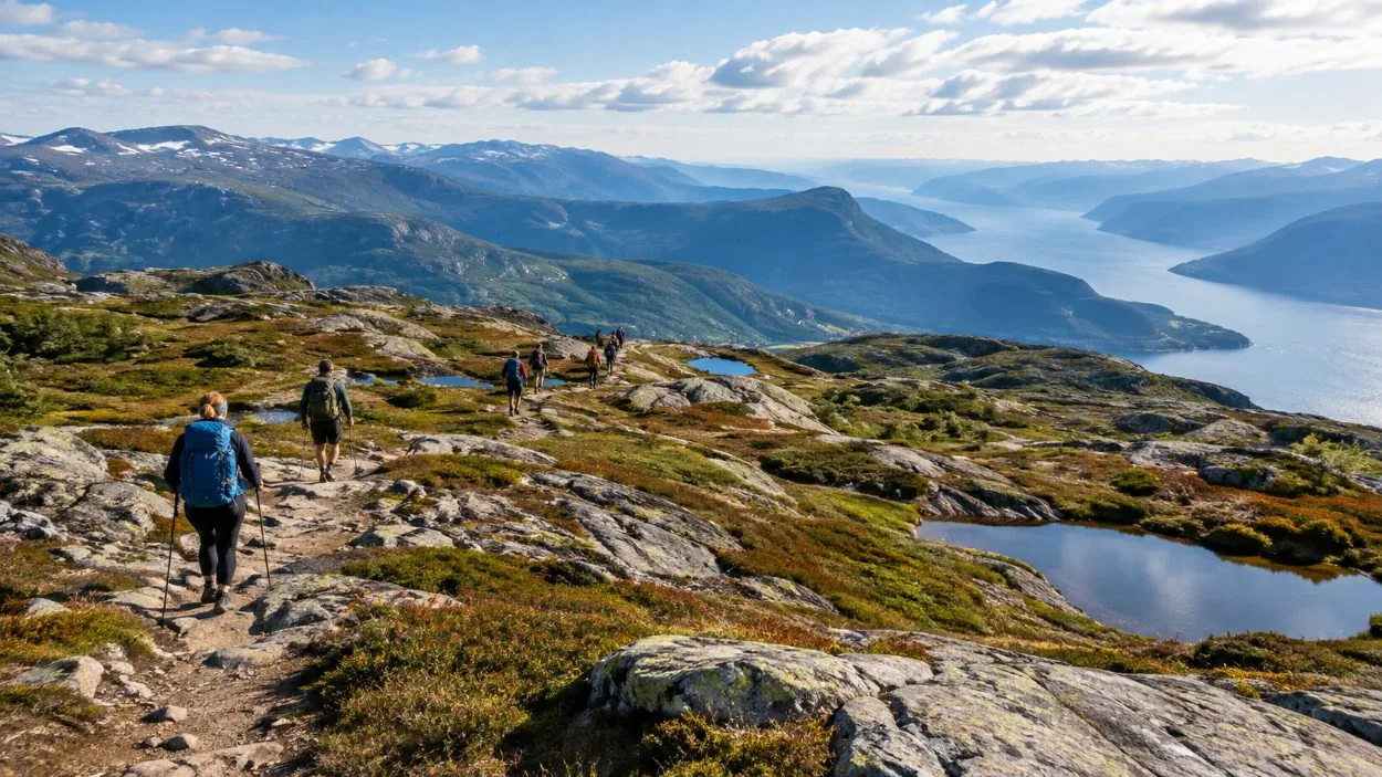
The gradient eases onto an open shelf and the trees drop away. This is where you get your first look back over the fjord, and it is also where the ground stops being a path. You are now placing each foot on individual blocks of granite rather than walking on a surface, which is slower and more tiring than it looks, and which is the honest reason this hike takes four to five hours: how hard it is.
Stage three: the boardwalks and the marsh
Wooden boardwalks carry you over boggy ground. They are there because the alternative is a churned peat mess, so stay on them even when a shortcut looks obvious. In rain the wood is slick and the sections either side of it are the ones that soak your feet, which is the argument for waterproof boots in one sentence: what to wear.
Stage four: the dip nobody mentions
The trail drops. It loses height before it climbs again, and this is the reason quoted elevation figures for Preikestolen disagree with each other so wildly. On the way out you barely notice. On the way back, that dip is a climb at the point when you had decided the day was over, and it is where I see the most sitting down.
Stage five: the second climb, and more rock
The last climbing section, on rock and boulders, with the fjord opening up on your left. The crowd usually strings out here in summer, and the views begin to be worth stopping for rather than worth pretending to stop for.
Stage six: the bare rock along the edge
The final stretch runs across open granite with the drop to your left. There is no exposure you have to negotiate, no scrambling, no place where you need hands. It is a walk. It is also the place where wind finds you and where anyone uneasy about height starts to think about it, so put the shell on before you get there and keep to the inside if that is what you want to do: the no-fence page.
The plateau
Roughly 25 by 25 metres, almost flat, 604 metres above the Lysefjord, with a half-metre gap running across it that has been monitored since around 1930 and is not going anywhere: the crack page. There is no railing, no fence and no barrier, by deliberate choice. There is nowhere to sit that is not granite, no shelter and no facilities. Most people stay twenty minutes to half an hour, which is about right, and in high season there is a queue of people waiting to have their photograph taken at the edge.
The local dialect name for the formation is Hyvlatånnå, roughly the plane blade, after the shape of a carpenter's plane iron. Preikestolen, the pulpit or the preacher's chair, was coined around 1900 by the Stavanger trekking association, which makes it a tourism name rather than an old one: why it is called Pulpit Rock.
The way back
The same trail in reverse, and it takes nearly as long. Everything that was a step up is now a step down, on legs that have already done it once. This is where the day is won or lost: the injuries page.
Count the distance posts on the way up. They come roughly every 500 metres, and having a number in your head instead of a vague sense of progress does more for morale on the descent than any amount of encouragement.
The other way up
There is a back-country route: roughly 9 km through forest and over Neverdalsfjellet, joining Preikestolen from another direction with a maximum of eight people. Longer, emptier, and about 500 metres of climbing: the hidden trail.
Booking the ride to the trailhead
Availability below; the rest are on the bookings page.
A reminder about what that widget is. It books the ride out of Stavanger and, on most of these, a guide. It does not book Preikestolen. Nobody sells a ticket to the trail: it is free, open and unguided, and you can walk up it without paying anyone a thing.
Frequently asked questions
What is the Preikestolen trail like?
Five kinds of ground in order: forest path, stone staircases, boulder fields, boardwalk over marsh, then bare rock along the fjord edge.
Is there any scrambling or climbing?
No. Nothing on the route needs hands, rope or equipment beyond boots.
Where does the trail start?
At Preikestolen Fjellstue, also signed Preikestolen BaseCamp, about 3 km past Jørpeland: getting there.
Is the trail waymarked?
Yes, with the red painted T of the Norwegian Trekking Association and distance posts roughly every 500 metres. In summer you cannot get lost.